OVERVIEW
The market for geospatial imaging analytics is expected to hit USD 27.15 billion by 2025, rising from 2020 to 2025 at a CAGR of 27.2 percent. With the advent of artificial intelligence and big data, this development can be attributed to major developments in the field of geospatial imaging analytics.


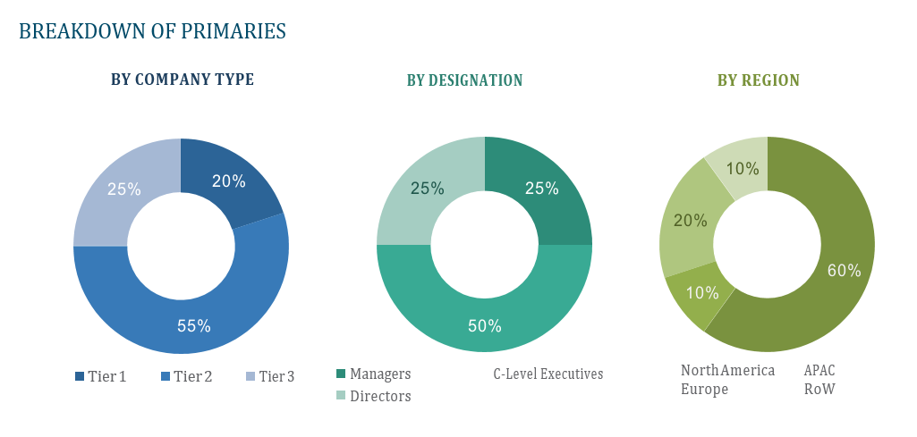
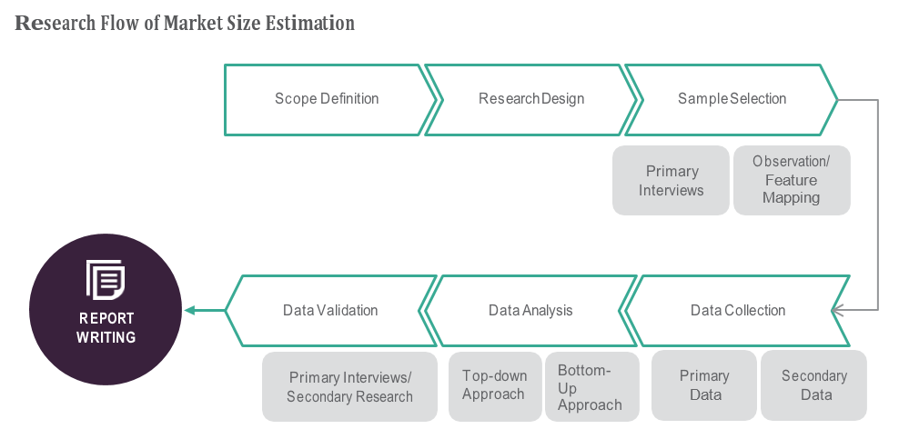

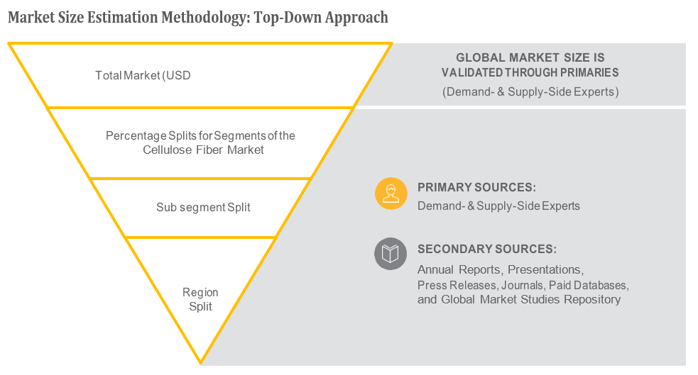
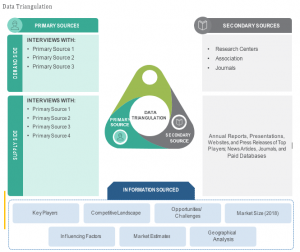
TABLE OF CONTENT
1 Global Geospatial Imagery Analytics Market
1.1 Study Objectives
1.2 Market Definition
1.3 Study Scope
1.3.1 Markets Covered
1.3.2 Geographic Scope
2 RESEARCH METHODOLOGY
2.1 Research Data
2.1.1 Secondary Data
2.1.1.1 Key Data From Secondary Sources
2.1.2 Primary Data
2.1.2.1 Key Data From Primary Sources
2.1.2.2 Key Industry Insights
2.1.2.3 Breakdown of Primaries
2.2 Market Size Estimation
2.2.1 Bottom-Up Approach
2.2.2 Top-Down Approach
2.3 Market Breakdown and Data Triangulation
2.4 Research Assumptions
3 Global Geospatial Imagery Analytics Market – Executive Summary
3.1 Market Revenue, Market Size and Key Trends by Company
3.2 Key Trends by type of Application
3.3 Key Trends segmented by Geography
4 Global Geospatial Imagery Analytics Market – Comparative Analysis
4.1 Product Benchmarking – Top 10 companies
4.2 Top 5 Financials Analysis
4.3 Market Value split by Top 10 companies
4.4 Patent Analysis – Top 10 companies
4.5 Pricing Analysis
5 Global Geospatial Imagery Analytics Market – Industry Market Entry Scenario
5.1 Regulatory Framework Overview
5.2 New Business and Ease of Doing business index
5.3 Case studies of successful ventures
5.4 Customer Analysis – Top 10 companies
6 Global Geospatial Imagery Analytics Market – Market Forces
6.1 Introduction
6.2 Market Dynamics
6.2.1 Drivers
6.2.2 Opportunities
6.2.3 Challenges
6.3 Porters Analysis of Market
6.3.1 Bargaining power of suppliers
6.3.2 Bargaining powers of customers
6.3.3 Threat of new entrants
6.3.4 Rivalry among existing players
6.3.5 Threat of substitutes
7 Global Geospatial Imagery Analytics Market – Strategic Analysis
7.1 Value Chain analysis
7.2 Product Life Cycle
7.3 Supplier and distributor analysis (Market share and product dealing strategies)
8 Global Geospatial Imagery Analytics Market – By Type (Market Size – & million/billion)
8.1 Imagery Analytics
8.2 Video Analytics
9 Global Geospatial Imagery Analytics Market – By Collection Medium
9.1 Geographic Information Systems (GIS)
9.2 Satellites
9.3 Unmanned Aerial Vehicles (UAVs)
9.4 Others
10 Global Geospatial Imagery Analytics Market – By Vertical
10.1 Manufacturing
10.2 Defense & security
10.3 Government
10.4 Environmental monitoring
10.5 Agriculture
10.6 Healthcare & life sciences
10.7 Energy, utility, and natural resources
10.8 Mining & manufacturing
10.9 Others
11 Global Geospatial Imagery Analytics Market – By Geography (Market Size – &
million/billion)
11.1 Introduction
11.2 North America
11.2.1 US
11.2.2 Canada
11.2.3 Mexico
11.3 Europe
11.3.1 U.K
11.3.2 Germany
11.3.3 Italy
11.3.4 France
11.3.5 Spain
11.3.6 Rest of Europe
11.4 Asia-Pacific
11.4.1 China
11.4.2 Japan
11.4.3 India
11.4.4 South Korea
11.4.5 Rest of APAC
11.5 Rest of the World
11.5.1 South America
11.5.2 Middle East
11.5.3 Africa
12 Global Geospatial Imagery Analytics Market – Entropy
12.1 New product launches
12.2 M&A’s, collaborations, JVs and partnerships
13 Global Geospatial Imagery Analytics Market Company Profile (Key Players)
13.1 Market Share, Company Revenue, Products, M&A, Developments
13.2 Google
13.3 Environmental Systems Research Institute
13.4 Digitalglobe
13.5 Urthecast Corporation
13.6 Fugro N.V.
13.7 Keyw Corporation
13.8 Harris Corporation
13.9 Hexagon AB
13.10 Trimble
13.11 Planet Labs
13.12 Company 11 & more
14 Global Geospatial Imagery Analytics Market – Appendix
14.1 Sources
14.2 Abbreviations


